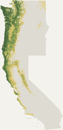
Soil readings are the middle 70% on find days since 2022.
The percent
A fixed scale tied to the map's colors (12% lightest, 70% darkest, 92% top), not the odds of finding one on a walk.
Limits
It can't see private land, access rules, or how hard a spot has been picked.
Fog drip and microclimates smaller than a weather grid are invisible to it.
Matsutake locations are blurred by iNaturalist, so that map is coarser.
Updates
Weather and pages rebuild every morning around 5 am Pacific.
The habitat and timing model was last trained on 2026-10-24.
Data
iNaturalist observations, gridMET daily rain and temperature, PRISM climate normals, NLCD 2021 land cover, SoilGrids pH, fire perimeters from CAL FIRE and NIFC, Mapzen Terrarium elevation, Open-Meteo weather, and OpenStreetMap and Protomaps basemaps.